Zambales
20-21 May 2006
Tubig... Ilog... (Water... River...)
People gravitate towards rivers. It is inevitable. Like giant umbilical cords, these meandering bodies of water fed our earliest communes giving rise to vast cities. It shouldn't come as a surprise that the water used to wet clays that marks the first pages of written history once flowed from a great river.
It may sound like I'm about to launch on a long monologue about the world's great rivers, but relax, I'm not. Last weekend, I went on a slight river trek with some members of UPM and their guests from the Occupational Therapy Department of the Philippine General Hospital.
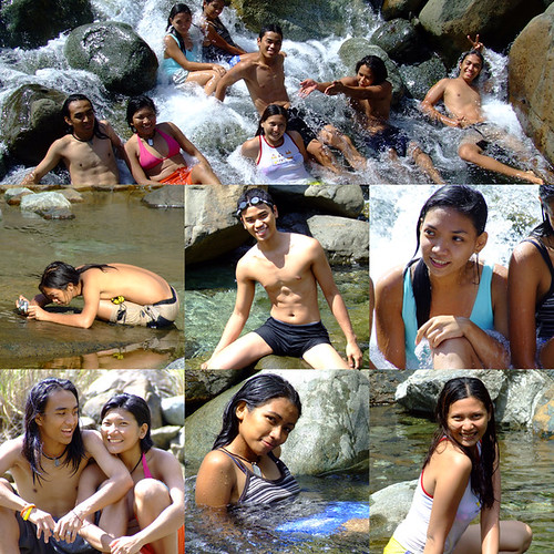
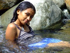
It was to be a low effort trek and being so close to water, it cannot be helped that at every bend splashing good fun was to be encountered.
Following rivers can really be loads of fun. Unlike climbing mountains where water are sourced from specific sites along the way - either bubbling from a spring or flowing from a small tributary, in river trekking all you have to do is stick your face on the ground whenever you feel like it and drink the way water is meant to be drank. Of course, you can always dip your water container if you happen to belong to the genteel class.
I assume you all have the common sense to not follow Pasig River and drink from her banks. Though I have to agree that Pasig River is chock-full of nutrients, drinking it can have disastrous effects on your health. There is a simple way to determine the safety of water in the wilderness: let the most obnoxious person in the group have a sip first and wait for an hour or two. If he or she remains obnoxious after that, then the water is pretty safe.
Normally, you should bring your own water. If you are unsure of the water source and Mr. Obnoxious refuses to drink, then you can treat the water with Puritabs (chlorine tablets - unfortunately, this brand seems to have been phased out in local drugstores), Betadine (pweh!), or use them fancy water purifying camping pumps in tandem with a UV pen (those are cool). For proper procedures, please read over the BMCs found at the UPM website or the documentation which comes with your water purifying device.
 The river is fed by surrounding mountains. We began collecting water for cooking and drinking only after we were sure that there were no human settlements further upstream. I knew it was pretty risky to be drinking untreated water from the wilderness that way but the water was so clean and free from sediments that it was hard to fight the temptation.
The water was so clear that you can always see the bottom of the river bed all throughout the trek. Even when it rained, the river remained surprisingly clear.
If local wisdom is something to go by, well, they did say that the water upstream was safe to drink.
Puros Bato
Progress was relatively slow as we trekked by the river. The terrain was almost alien. I entertained myself by thinking I was an explorer in Mars as I hopped from one boulder to the next. Of course, in Mars the rocks would have been sharper since there isn't water to shape rocks the way it does here on Earth (I don't know why I'm telling you this, it's my fantasy in the first place and I don't have to show the plausibility of my own pantasya).
Though at a very gentle incline, boulder strewn terrains are the most dangerous terrain in my opinion. Piled up boulders can be pretty slippery, notoriously unstable and in places where erosion had broken it, can be pretty sharp.
To make matters worse, constantly hopping from one boulder to the next for hours can induce a trancelike state. Sometimes you find yourself concentrating on plotting your route without thinking where you are placing your feet. Sometimes you will be focusing on where to lay your foot that you will fail to see that you are heading towards a precarious set of boulders with deep dangerous spaces.
Most injuries I have come across in the wilderness usually involved boulders. Limbs can get wedged in the spaces and with the aid of gravity either pull a muscle or tendon, dislocate a joint, or worse still break a tibia.
 I have made mention a number of times in this blog regarding a reddish alga that when dry has no notable quality but when wetted becomes as slippery as ice. On this trek, we had to cross a field of boulders covered in these while it began to rain. To understand how slippery it was, we all knew the nature of this algae and were very cautious in our footing but still a number of us fell and came out of that field with badly bruised knees. On another section of the trek, I myself had my legs pulled from under me as I gingerly shifted my weight across a flat slab of rock covered in red algae.
Litratista's Lament
Water and digital cameras don't mix. It was hard negotiating thigh deep water knowing your digital camera is sitting vulnerable inside your belt pack inches from the water's surface.
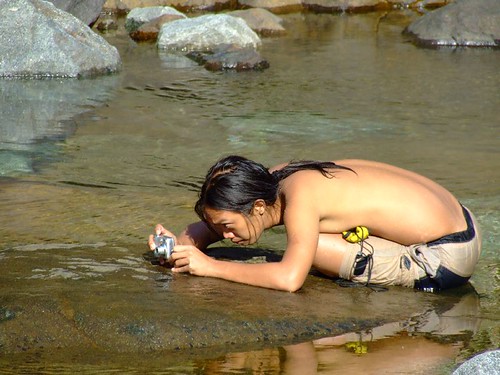
What would take a few seconds took minutes as each measured step is test and retested to ensure a secured footing while water rushed by making you giddy and somewhat disoriented. Every boulder that stuck out of the water's surface is a godsend and I didn't hesitate to grab onto anything to provide that added stability - even if it meant grabbing onto and shoving an already off-balanced companion just to secure myself. Better their digital camera than my digital camera I'd always say.
As a personal rule, I always bring along where I'd store my camera a pair of plastic bags and a thicker resealable bag just in case it rains or if we had to cross waist deep water. When that happens, the camera gets wrapped up in plastic and shoved into a dry bag. This in turn will be shoved into my water resistant back pack. This method has so far gained my confidence. I'm not so sure of it though if ever the bag becomes completely submerged - which does happen.
Packing Light
If there is anything I've learned from my Bicol trip, it would be the virtue of packing light. For this trip, I've foregone my flash unit and backup camera. I was meaning to bring a reflector and experiment with outdoor portraiture but decided against it at the last minute.
I've brought only the essentials: my Finepix camera, a tripod, skylight filter, circular polarizer, my Opteka 0.45x add-on lens and an extra set of batteries. All these except for the tripod went inside a padded belt bag I bought at the mall for 400 pesos.
These make up my basic outdoor photo gear. If I must bring more, I'd want to bring along neutral density filters and other creative filters for landscape photography - in particular those split neutral density filters to prevent the sky from burning out. It has also come to my attention that certain bag liners do come with a silver lining which can double as a nice reflector for portraiture. Bringing photographic equipment that can double for another purpose is ideal for trekking where weight is a major consideration.
Now, if I were to be allowed a certain amount of decadence, then I'd want a Hassie with a nice prime 17mm lens if you please. Seriously, I wouldn't mind the weight.
Quiet Water Runs Deep
After hopping from one boulder to another for about two and a half hours, we encountered the deep pool locals call Tutan. I don't know if the people we've spoken to were being serious about this because "Tutan" is only a syllable away from the vernacular "Kantutan" which means to have sex. Needless to say, the introduction of the site to us resulted in sniggers among the less mature members of the group.
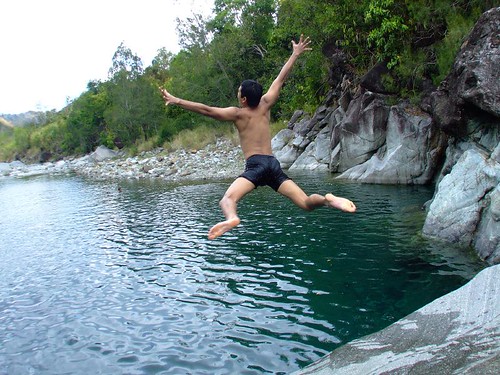
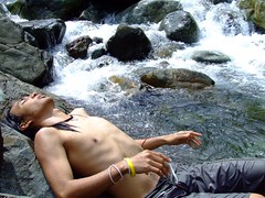
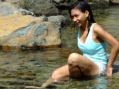
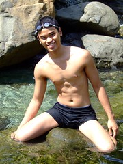
By the time I arrived at the pool's site, members of our group were already screaming at the top of their lungs as they jumped off boulders and into the crystal clear water of Tutan.
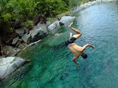
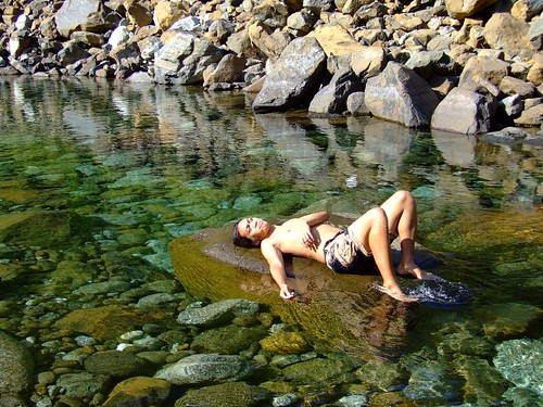
The pool was surprisingly deep - about 15 feet deep at the center. Huge boulders the size of small buses lined the pool with only their top most surface showing. Blocking the cascades upstream is a large boulder wedged between smaller rocks beneath the surface. It makes a perfect platform to dive into the pool or sunbathe.
 A rock formation on one side provided a tiered platform for diving where the highest point is about 20 feet from the surface of the water. A good and secured push is required to clear outcrops above and below the surface of the water. Looking down from such heights was exhilarating - especially when you're psyching yourself for the jump.
Some of the platforms are located in such a way that backtracking is more dangerous than jumping. It is a great motivator for acrophobics to finally jump if you ask me.
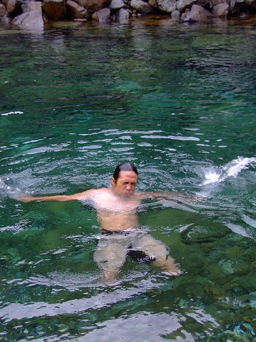
Exploring the depths of the pool revealed thumb-size silver fishes and pinky-size shrimps swimming about in schools. Some of us contented ourselves observing these perky creatures as they dart about submerged boulders.
It might come as a surprise to some but snorkels and goggles are standard gear for some mountaineers. As for me, I have a special place in my bag for goggles. Now, to make room for flippers...
Watermark
If ever you've gone out to look for a new home, you've probably been advised by relatives or friends to check the back of the sink or the wall behind the refrigerator for watermarks. If present, these show how high flood water had risen in the past. Generally, you wouldn't want a house that displays these marks.
On this trek, I couldn't help but notice what looked like watermarks and scars that can only be created by a raging river at levels far above the top of my head. For one, driftwood is pretty unmistakable and seeing large chunks of these wedged between boulders 12 feet above where we were walking was not really that reassuring.
I haven't witnessed a flash flood so I cannot help it if my visualization of what can happen is a composite of footages from the Asian Tsunami and scenes from the movie The Day After Tomorrow. Adding to my anxiety was the heavy rain that fell when we resumed our upstream trek from Tutan.
For all we know, there could be a major downpour upstream and in the mountains that drained into the river. For all we know, a raging body of water could be heading our way just around the bend. I kept myself pretty much preoccupied looking out at front and plotting escape routes through the maze of boulders just in case the unthinkable does happen.
I noticed that the sides of the gulley were pretty steep; and were pretty much vertical for about 5 to 8 meters in some stretches. Looking at it, I can imagine the banks of the raging river cutting through the gully and etching these deep vertical walls. I imagined huge boulders being washed out from the side of the mountain and after losing its grip on the soil, tumble like a rubber ball into the river.
Perhaps it was a shared anxiety, because as we progressed and as the level of the river rose, I noticed our group trekking ever closer to the slopes of the gulley and away from where the river rushed.
Tulak Palayo sa Kampo
After about two hours from Tutan we reached a bend in the river with a course sand bank at the inner elbow and a line of sharp rocks on the other. We have reached the campsite. Though camping at the sandy bank was tempting being so conveniently close to the water, common sense saw us pitching our tents way up beyond the banks.
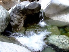
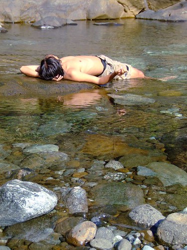
The water was again surprisingly deep - though not as deep as Tutan. Just around the bend was a cascade which provided a constant yet soothing noise at the campsite.
Just before dark, I found myself exploring further up the river by myself. I had this inkling that I might find an entrance to an underground stream over yonder where I made out a slight depression on the side of a steep incline. Though the river and its flow were obvious, there are streams flowing into the river from the slopes straddling it for which their sources are unbeknownst to us.
When I found myself face to face with my indentation, what I found was just that. But at the center of the unusually clear depression was a sandy patch with concentric white bands at the edge. That made me wonder: do we have quicksand in the Philippines? I inched closer towards the banded edge and decided to dip my toes into it and see. After making sure of my footing, I gingerly dipped my toe in.
It was a complete waste of time. It was just that: a patch of sand. Walking back to camp, I vowed to trace that river to its source one day.
Saan Yun?
To get there, join a responsible and MFPI registered mountaineering organization, internalize your BMCs (Basic Mountaineering Course) and learn by heart your LNT (Leave No Trace policy for climbers and trekkers).
Once you've got that out of the way, get a map and explore!
Too many people have asked me not to divulge the location of the site or provide instructions on how to get there. If you've been following what I've written in this blog, you are aware of my frustrations with irresponsible backpackers. They will enter the wilderness without a care in the world for the trash that they leave behind. Worse, they would etch rocks and trees that had been there even before the birth of their grandparents with their meaningless nicknames and stupid personal phrases to live by like: "Punks not Ded" or "Jhun loves Jhane".
Go see my Pico de Loro entries and take a look at the mindless markings on the rock formation. You will come to understand the reason why many mountaineers assign to themselves that role as wards to these places of tranquility and beauty.
If it was very hard to get at, then I wouldn't hesitate to publish an itinerary. Usually, the fools I'm referring to here don't have the resources both monetary and physical to get there anyway. But this hideaway is relatively easy to get at hence our hesitation. We don't want another disaster like that of Pico de Loro, Famy, and Majayjay where every Jhun, Jhane and Jhenny have left their indelible mark on every rock, tree and cranny.
I'm not denying anyone their right to enjoy what is also theirs. It is not exclusively mine to begin with. All I'm saying is don't ask me for directions to Bagsit River.


7 comments:
ganda nga ng ilog. a friend went with the UPM sometime in late april (i think) to the same river and i was told the experience was wonderful. i thought of inviting myself to the may river trek of UPM but found my schedule too busy then for weekend recreation.
Great pictures, great writing. Brod, you should (seriously) consider working on a coffee-table book narrating the places you've gone to. Maybe we can pitch the idea to Anvil or something.
ignorance is never the answer. In my opinion, its precisely those who make an effort to go and visit such a beautiful place who will help preserve it. Look what happened to Anilao and the mabini area. Its the locals who should be taught how to take care of their surroundings. Refusing to tell others how to get there properly is like burying your head in the sand. Besides, this is the information age so good luck with that.
this is the fourth blog post na nabasa ko about this hidden lagoon.. I know how to get here and just like you I prefer to call this pool "hidden lagoon somewhere". Sana manatiling sikreto ang lugar and to those who will blog about this place, keep it a secret! I will support you in keeping this place a secret. If you have time sir, you can replace the name of the pool and river by something made up.
Post a Comment